

The Struggle for Long Island: Archaeologists & Historians Search for Long Island’s Revolutionary War Battlefields
On 5 Jun, 2019 0 Comments
On April 15, 2019, archaeologists from The LAMAR Institute began a month-long search for three significant American Revolutionary War battlefields on Long Island, New York. The project, entitled, “The Struggle for Long Island: Expanding Revolutionary War Studies in New York” examines military sites occupied by Loyalists including the stronghold of Fort Slongo; Setauket, which was a fortified church; and the fort and Loyalist headquarters known as Fort Franklin/Lloyd’s Neck. Patriot attacks on the three forts resulted in a Patriot victory at Fort Slongo. Patriots retreated at the other two, including Fort Franklin where Patriots were joined by French allies. This project seeks to locate and delineate the three battlefields and to interpret the findings, advancing our understanding of Long Island’s important role in the American Revolution. Work was funded by a $60,000 American Battlefield Protection Program grant from the National Park Service and $5200 in contributions from the LAMAR Institute.
After the American defeat at the Battle of Long Island in 1776, Long Island became an important supply resource for the British army in New York City and a defensive front line to the American Forces in New England. The island supplied forage to an army of thirty thousand or more troops that were encamped within the New York region. Forage collection on the island was transferred to its shores and loaded on ships bound for New York City. British and Loyalist troops established a network of fortifications across the length of the island to defend these points of forage collection and to act as armed supply bases against rebel attack from the Long Island Sound.
Fortifications were established on high points of land and provided access to waterways and major roadways. On Long Island, the hilly landscape of the north shore combined with its natural water inlets and harbors off the sound made this prime landscape for establishing the greatest number of British posts. There were more than a dozen places on Long Island where military defenses were constructed. These defended positions created ongoing contention between the two opposing armies across the Long Island Sound resulting in several military engagements. The battles themselves became flashpoints in the struggle for the island, a somewhat civil war between Americans; those loyal to the crown were pitted against their Patriot brethren (many of whom were former inhabitants of Long Island). The three battlefields selected for the battlefield study were all fortified Loyalist garrisons located on the north shore of Long Island.
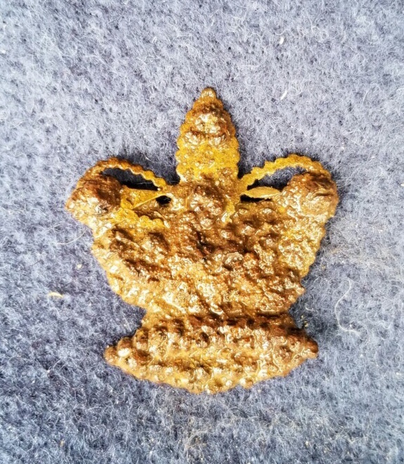
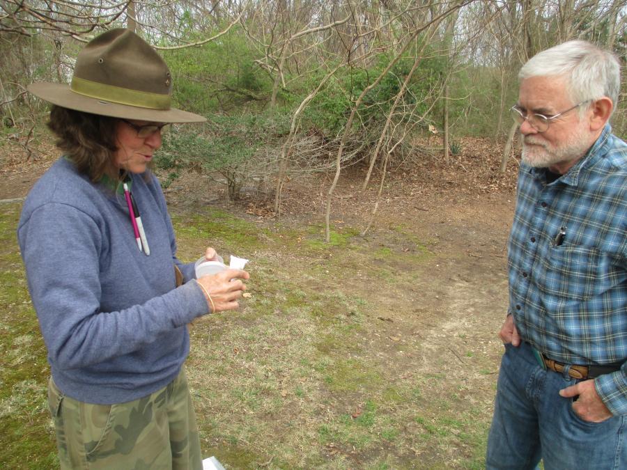
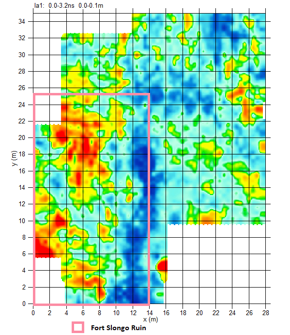
The project initially included extensive historical research at facilities on the Eastern Seaboard. Field investigations included Ground Penetrating Radar (GPR) surveys and systematic controlled metal detection surveys. Through the use of metal detectors, field researchers were able to find lead musket balls, jacket buttons and accoutrements that helped to possibly tell them which troops were involved in the battles. The survey also gives potential evidence of how many people were possibly engaged in the conflicts. Ground Penetrating Radar surveys completed at the sites give deep underground mapping of the features. This aids in delineating underground structures such as fortification works and buildings formerly on the battlefields. The field work is planned to be followed up by laboratory analysis and future public presentations in the Long Island region. Resulting interpretation is also planned to be documented in a report available to the public on the LAMAR Institute’s website by September 2020.
David M. Griffin is the author of the book ‘Lost British Forts of Long Island’ by The History Press, 2017. During his research for his collaboration on the Struggle for Long Island Project, he made a visit to The Loyalist Collection in 2018.
Note: This material is based upon work assisted by a grant from the Department of the Interior, National Park Service. Any opinions, findings, and conclusions or recommendations expressed in this material are those of the author(s) and do not necessarily reflect the views of the Department of the Interior.
SUBJECTS: New York, archaeology, Long Island, American Revolution, military

Add new comment