- Submitted on
- 2 comments
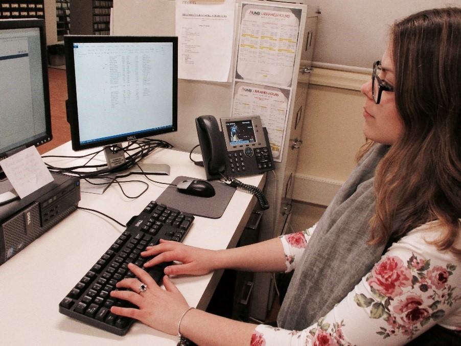
“I need a job” says one bleary eyed and impoverished student to another; “one that is within my academic field.” However, in order to eventually get that dream job instead of a nightmare career (where the employee watches the clock tick to 4:30 with hungry eyes and assumes the running position), a person needs experience. What does “experience” even mean, and why is a student’s degree not enough? My answer: student jobs on campus are the true academic riches, as it is not only experience that is gained, but also the pursuit of a career related interest. Being an avid and unashamed history nerd, the summer of 2017 presented a wholly unique and enriching opportunity that I will say in years to come was the turning point of my undergraduate career success. That leads me to Esri GIS (Geographic Information Systems) story mapping―something that I had never encountered before applying for the job as Story Map Designer at the Microforms Department in the Harriet Irving Library (why they hired me, I do not know).
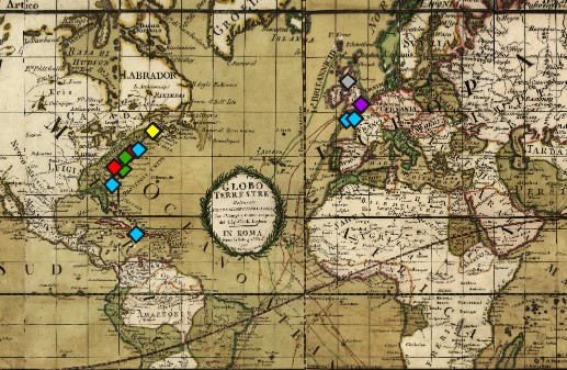
GIS combines narrative text, maps, and multimedia content to convey geographical movement that corresponds with the narrative being told. Hence, the story correlates to the map(s) being displayed to create a visual and cohesive presentation that is equally engaging and informative. The content and geographic maps can be contemporary or historical (or both, to show continuity and change over time), depending on the nature of the project. An example of a historically-based story mapping project is the “New Brunswick Loyalist Journeys,” where I designed the layout and visual aesthetics of ten story maps. This project tracks the displacement and resulting exile after the American Revolution of ten Loyalists, as well as their later arrival in Parr Town (present-day Saint John) and St. Anne’s Point (present-day Fredericton).
The intention behind this project, which combines geo-referenced historical maps and biographical content, is to illustrate the lived experience of the Loyalists’ exile and their diaspora to New Brunswick. The ten GIS story maps are designed to represent the Loyalists as dynamic and complex people. Thus, the ten Loyalists featured in this project range from a diverse array of backgrounds, including a Black Loyalist, a female Loyalist, an Anglican minister, two Southern plantation owners, and military officials. This project marries historical figures, events, and battles (the maps chosen are also era appropriate, both designed in the late eighteenth century) with modern tracking coordinates. Underlain beneath the historical maps in “New Brunswick Loyalist Journeys” are topographical maps; therefore, the points that are plotted reflect a modern placement, as county boundaries and place names changed often.
The educational benefit of integrating statistics, historical or contemporary events, political movements, social commentaries, and more with interactive technology is invaluable. As with “New Brunswick Loyalist Journeys,” the physical and emotional journey of the Loyalists becomes more impactful as their dislocation is visually illustrated when tracking their migration—at a time when transportation was limited, dangerous, and uncertain. It is only through this Atlantic World project that the importance of Digital Humanities came into sharp focus for me, and, with it, the realization that merging history and technology is not a future phenomenon but, rather already happening in the present.
This innovative project took seemingly mundane facts about a person’s history (where they travelled to, with whom, at what time) and created a visual journey of their life with its hardships of multiple displacements, exile, and loss (financial, social, and familial). It also revealed the reformation of community and familial relationships that weathered a Loyalist expulsion from their American homeland. Although a romantic conceptualization, it is important to emphasize that certain individuals suffered more acute socio-economic and political hardships than others. In particular, Maritime society racially discriminated against people of colour during this period, resulting in free Black Loyalists indenturing their labour to white colonials to avoid starvation. Single Loyalist women with no stable financial income were also vulnerable to destitution and malnutrition.
The dynamic and diverse lives of these ten York County Loyalists comes to life through Esri GIS story mapping, as their names re-enter the historical record. Their journeys, visually recreated, tell their 233 year old story. My involvement in creating these visually engaging story maps has positively influenced my academic career, while providing experience (in my field!) for my professional career. Therefore, I went from academic rags to riches with the New Brunswick Loyalist Journeys Story Mapping Project.
Recommended Sources
https://storymaps.arcgis.com/en/
http://www.esri.com/esri-news/arcuser/summer-2013/what-can-you-do-with-a-story-map
Zoe Louise Jackson is a student assistant for the Microforms Unit at the Harriet Irving Library. She is currently in her fourth year of her Bachelor of Arts degree at UNB in Honours History.
Comments Add comment
Loyalist story map project
Project information
Hi Susan! Thank you for your interest in our project. The first phase of the project includes biographies of ten loyalists from York County. You can get the links and names here: https://loyalist.lib.unb.ca/story-maps. If you are interested in researching a particular loyalist, The Loyalist Collection is a great resource and we are happy to help.